Response to wildland and urban interface incidents requires effective coordination of resources from multiple agencies and jurisdictions. Tablet Command and TC Mobile users have grown accustomed to being able to visualize the location of other apparatus throughout response to incidents. To support enhanced situational awareness and for improved crew safety, Tablet Command has developed AVL sharing. Departments that elect to share vehicle locations with other Tablet Command customer agencies, are able to see the locations of neighboring agency apparatus in Tablet Command and TC mobile. These resources are clearly marked with agency identifiers. This feature represents a significant step towards the common operating picture that has long been a goal for response and management personnel.
Tablet Command's integration with FireMapper provides real time map annotation which is instantly available to all resources using Tablet Command and TC Mobile. Multiple users can annotate the map using standards based symbology to show data points such as fire perimeters, evacuation routes, damage assessments and more. The annotated maps created in FireMapper are not only viewable in Tablet Command and TC Mobile, they can be added to ESRI based maps, and exported in a number of popular formats including Geospatial PDF, KMZ, KML, GPX, and GeoJson. Read more about FireMapper here.
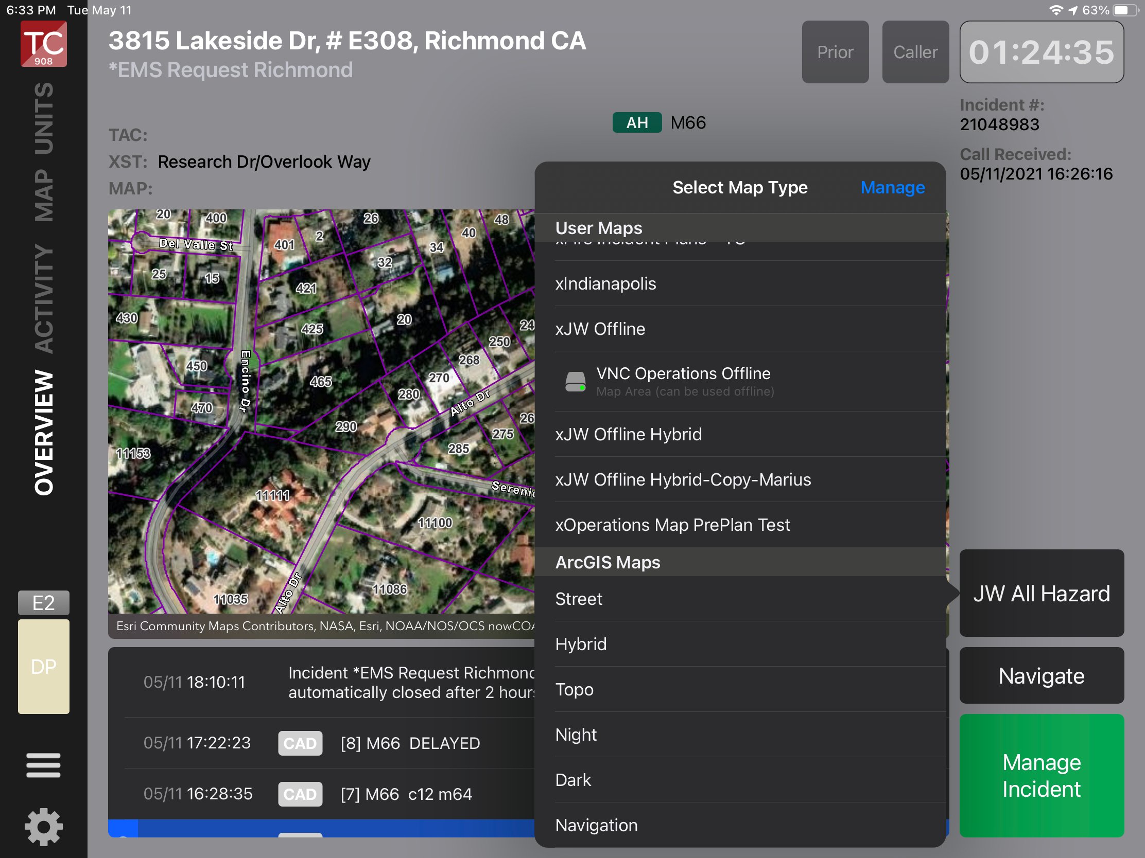
Using the proven power of ArcGIS Online, customers can create offline copies of their custom user maps This means even in a unconnected environment, critical GIS information such as hydrant location, parcel maps, address points, pre plans, and evacuation zones can be accessed by Tablet Command users.
Tablet Command and TC Mobile support real time access to public facing video feeds, including the ALERTWildfire camera network, traffic cameras, drone video and virtually any video source that has a public facing internet address. Consider the advantages of being able to visualize an incident prior to arrival through a simple, intuitive user interface all within Tablet Command and TC Mobile.
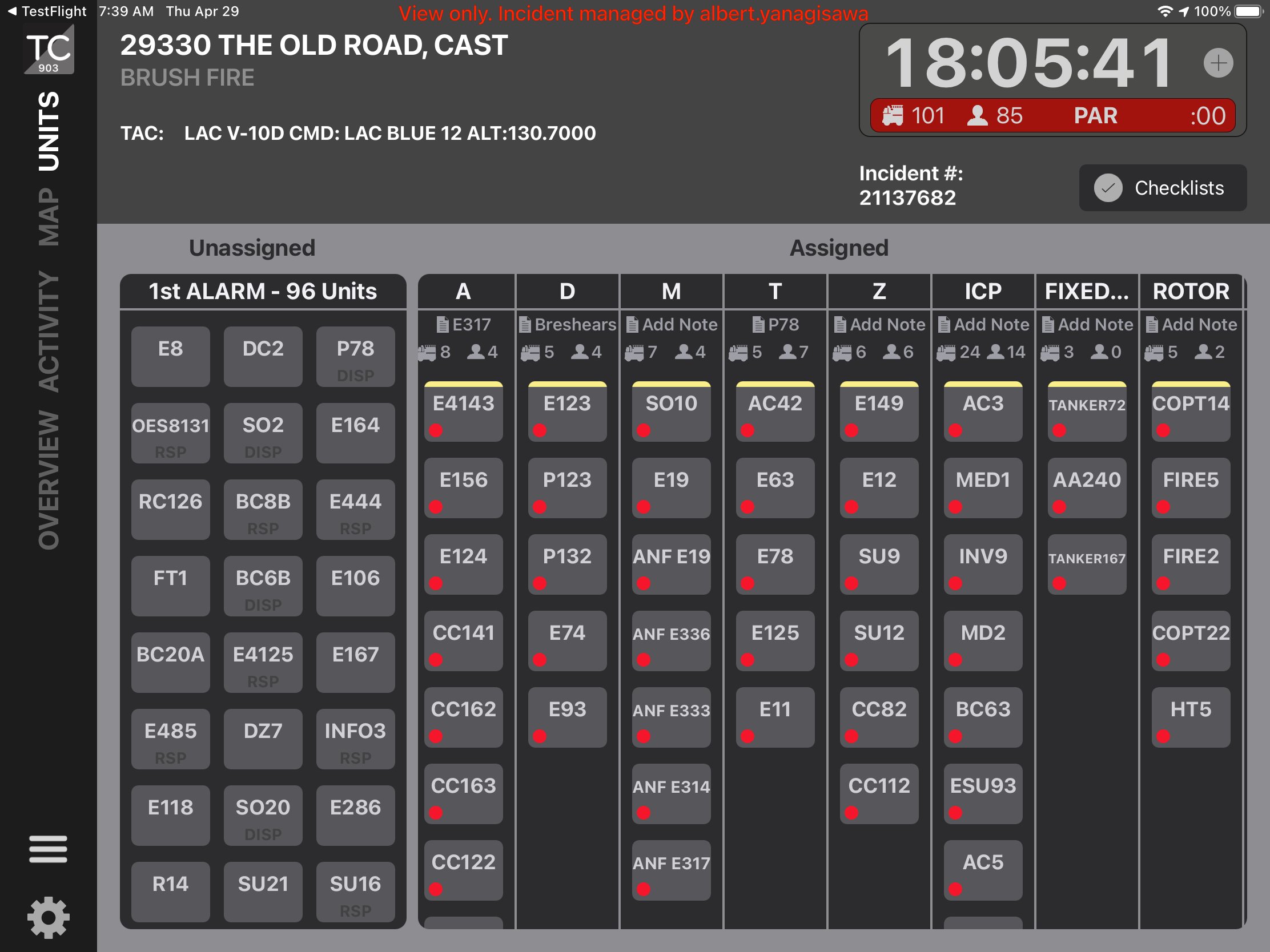
Use Tablet Command to manage complex and dynamic incidents from initial response through demobilization. Built around the principles of the Incident Command System (ICS), incident commanders can easily execute strategic and tactical changes throughout the response process. From a single alarm incident to a complex mutual aid response with hundreds of units and personnel, Tablet Command supports true resource accountability and a common operating picture at every level of the incident. With a staffing integration commanders can also see the riding list for each resource. Additionally, Tablet Command captures time stamped incident activity records that are exportable and can be used to support reporting, after action analysis, and cost recovery activities.
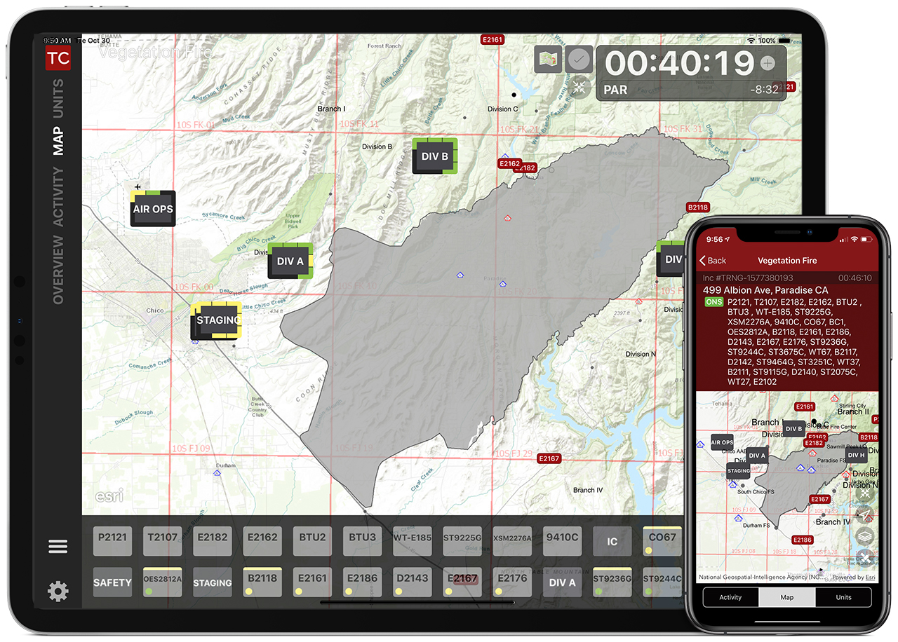
Incident Commanders can toggle between managing resources in the Units View or in the Map View which includes FireMapper annotations and GIS data. Individual resources or entire divisions can be shown on the map to support real time situational awareness at every level of an incident throughout the response.

