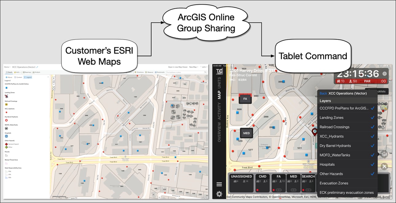
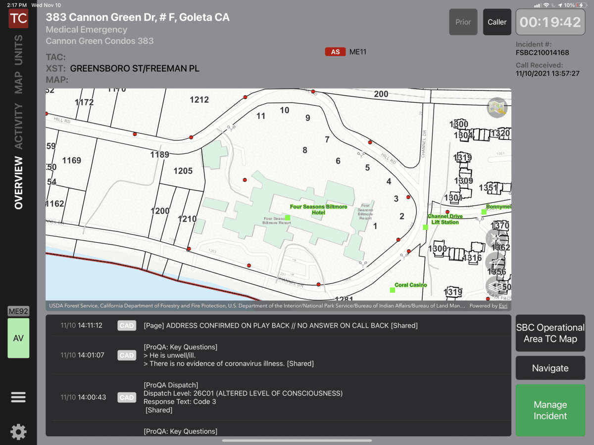
Tablet Command integrates with our customer's ESRI mapping solution using Arc GIS Online group sharing to seamlessly publish custom GIS information to all Tablet Command and TC Mobile users in the Tablet Command account. The Tablet Command and TC Mobile apps use ArcGIS the ESRI mobile SDK to display key response information like hydrant locations, addresses, parcels and pre-plans directly on Tablet Command maps. Expanding from there, customers can add live camera feeds, evacuation zones, trails, flood zones, responsibility areas, the list goes on and on! The biggest difference between the Tablet Command mapping solution and most Mobile Data Terminals is that as soon as a map is updated in ESRI, it is available to all Tablet Command users in the field.
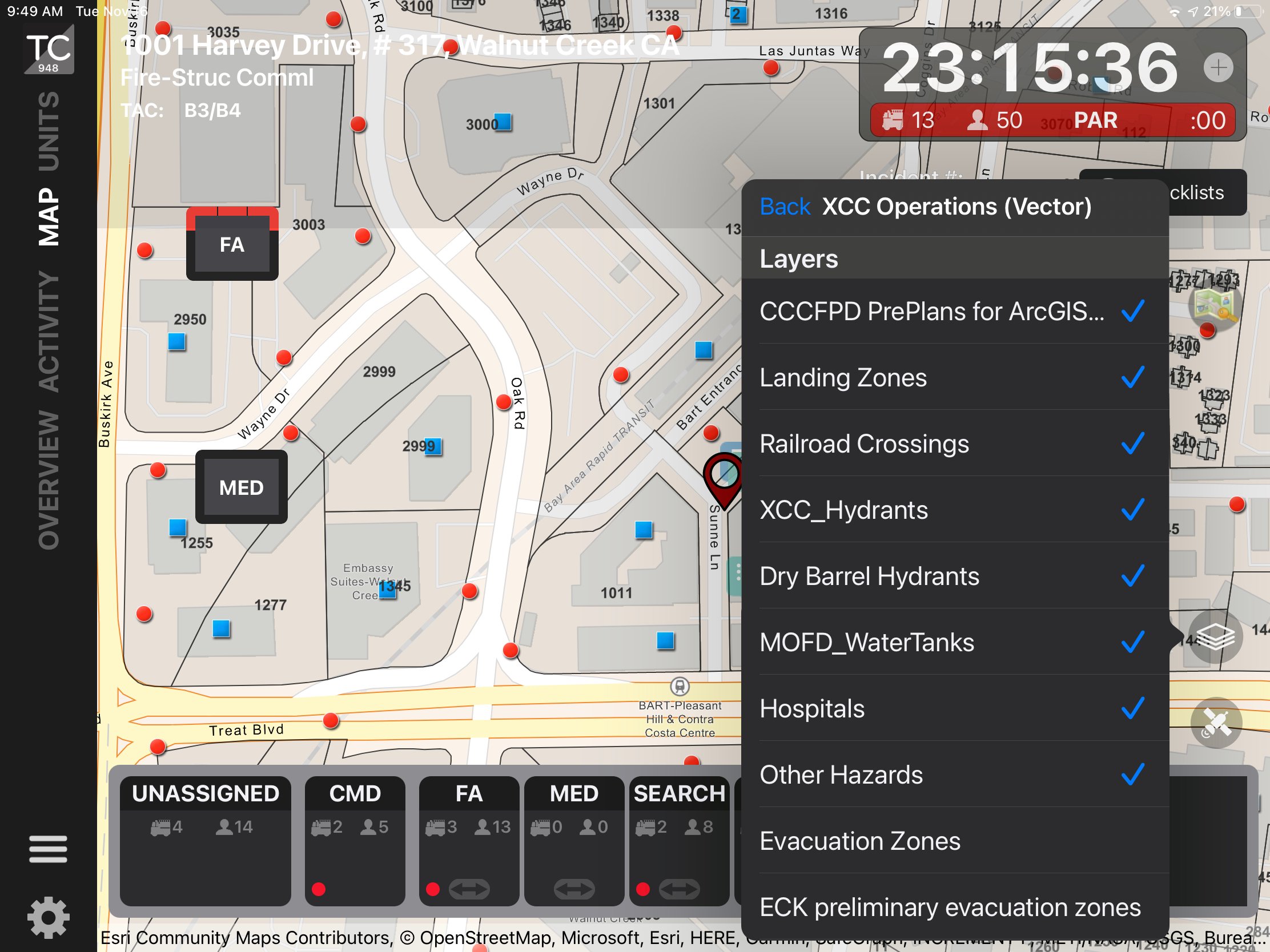
Virtually any layer you can add to an ESRI Web Map will display in Tablet Command. From simple points layers like hydrants and addressees, to live camera and video feeds, evacuation zones, and more.
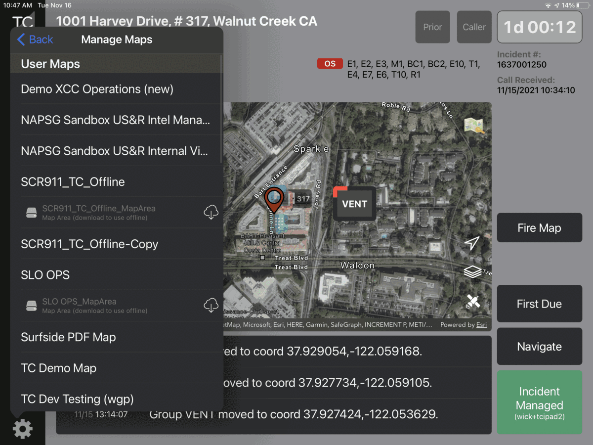
Through ESRI tools, we support two versions of offline maps, Arc GIS Online Offline Map Areas and Mobile Map Packages (MMPK's). Users can download Pre-Plan or MMPK maps to their devices and access most of the same features as an online Web Map even in areas with poor to no connectivity. The offline maps are also significantly faster to draw even with good connectivity. Your GIS staff can create and update these offline maps using Arc GIS Online and Arc GIS Pro tools.
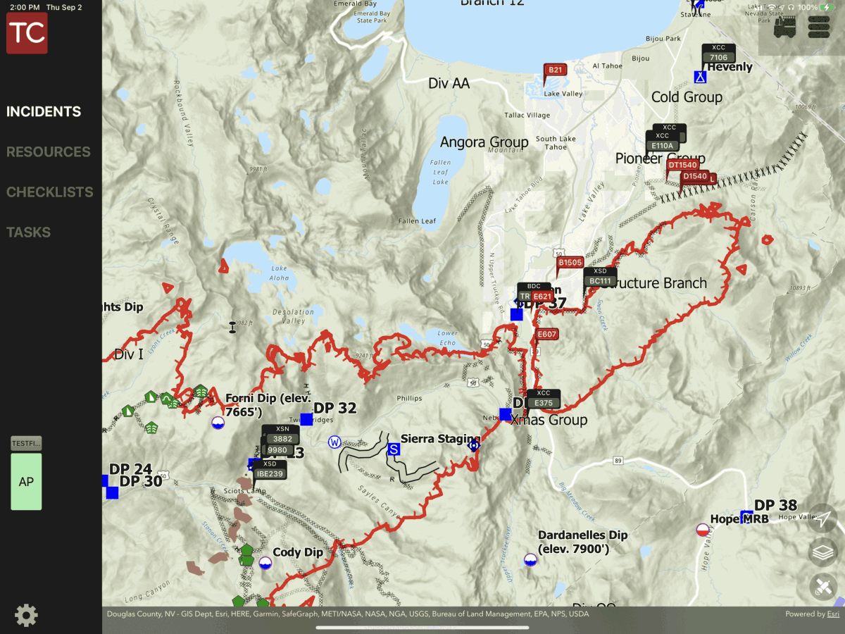
The ESRI group sharing and editing tools allow incident specific maps for major natural disasters and wildland fires to be integrated into customer accounts and made instantly available to crews working in the field, without additional logins, or applications. One advantage of this is for Strike Team leaders to track their resources directly on the incident maps.
Tablet Command is the ideal solution for displaying and quickly accessing your agencies Pre-Plans by leveraging ESRI ArcGIS Online in Tablet Command and TC Mobile. You can choose to place pre-plan points directly on the map, attach pdf's and images to points in a feature service, or store the pdf's on device and access with a third party application. We also integrate with third party pre-plan solutions like First Due and Intterra. Learn More...

